 Consulting
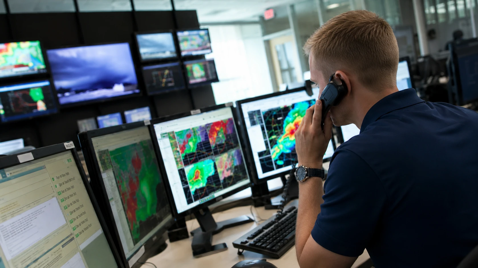
Forecasting, planning, and operational weather support.
For events, businesses, field operations, WBGT monitoring, outdoor safety, and weather-sensitive decisions.
EKAS turns weather data, aerial evidence, field context, and professional meteorological judgment into clear deliverables for clients who need proof, perspective, and action.
Every project starts with discipline: define the question, gather reliable information, analyze the conditions, translate the findings, and deliver a usable product.
Consulting
For events, businesses, field operations, WBGT monitoring, outdoor safety, and weather-sensitive decisions.
 Forensic
For wind, hail, hurricane, flood, rainfall, tornado, lightning, construction-delay, and incident questions.
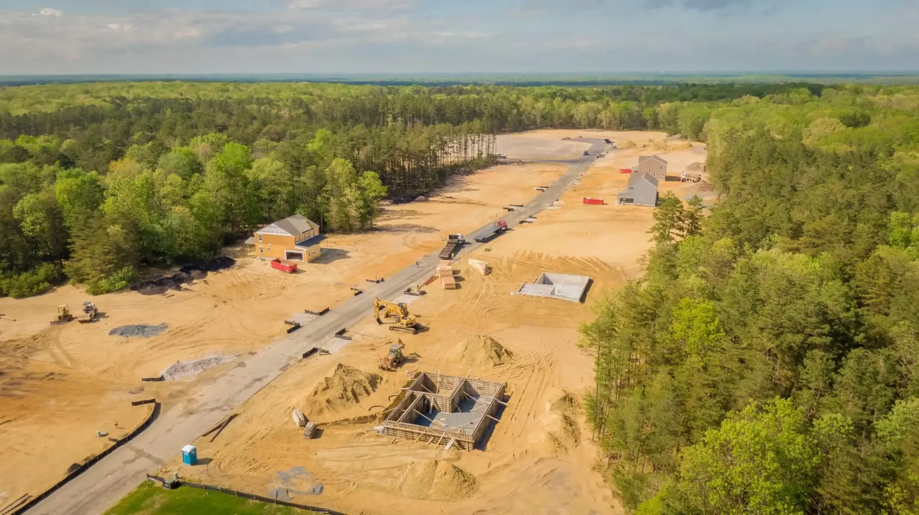 Aerial
For roof documentation, site context, construction progress, real estate, storm damage, and aerial exhibits.
This is the core workflow behind consulting, forensic, and aerial projects. The details change by service, but the structure keeps the project professional and easy to follow.
Confirm the client goal, location, timeline, deliverable need, conflict concerns, and whether EKAS is the right fit.
Define the service lane, expected deliverable, fee structure, schedule, data needs, and client responsibilities.
Collect weather records, radar, satellite, warnings, client materials, site evidence, or flight-planning information.
Interpret the weather or site conditions and translate complex data into a clear, professional explanation.
Finalize the report, briefing, imagery package, exhibits, consultation, or monitoring summary for client use.
Each lane is organized around the client’s actual need: forecast guidance, forensic reconstruction, aerial evidence, or a combined weather-and-drone package.
Useful for outdoor events, construction schedules, field work, sports, marathons, festivals, filming, heat safety, and operational weather decisions.
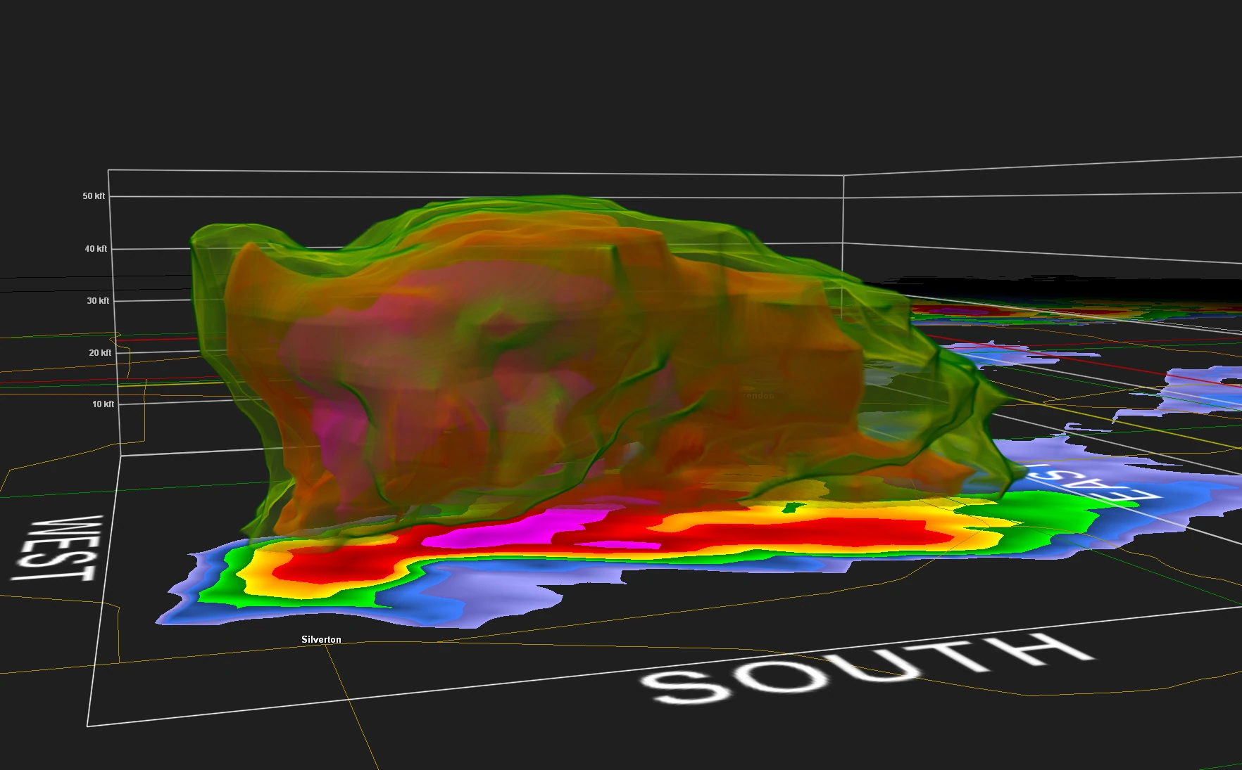
Forensic meteorology reconstructs what happened at a specific place and time using official records, radar, satellite, surface observations, storm reports, warnings, and professional interpretation.
Aerial imagery helps document what is visible from above, while meteorology explains what the weather was doing before, during, and after the event.

The rare value is the combination: a meteorologist who can interpret the atmosphere and a FAA Certified UAS Pilot who can document the site. Most drone pilots can show damage. EKAS can help explain whether the damage pattern makes meteorological sense.
Aerial imagery combined with radar, warnings, MRMS, storm reports, wind direction, ASOS data, and satellite.
Forecasts, lightning/wind/heat monitoring, drone overwatch, and post-event documentation.
Flood, drainage, roof exposure, tree risk, coastal surge, wind vulnerability, erosion, and ponding context.
Aerial damage maps, flood extent imagery, debris context, weather timelines, and recovery-support visuals.
The right evidence depends on the project. EKAS organizes data sources, site information, weather graphics, and final deliverables into a usable client product.
NOAA/NCEI, NWS, radar, satellite, observations, storm reports, warnings, tides, rainfall, and climate records.
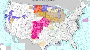
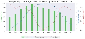
Watches, warnings, advisories, model guidance, surface analysis, storm timing, lightning, wind, heat, and WBGT.
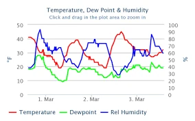
Charts, timelines, graphics, annotated maps, storm tracks, damage context, and weather-risk explanations.
Briefings, forensic reports, exhibits, aerial packages, storm safety audits, due diligence reports, and monitoring summaries.
Explain the situation, upload what you have, and EKAS will help identify the right next step.